Showing posts with label Netherlands. Show all posts

St. Elizabeth's Flood of 1421

St. Elizabeth's Flood of 1421 

In the early hours of November 18, 1421, a fierce storm swept across the Netherlands, unleashing one of the most devastating floods in European history — the St. Elizabeth’s Flood. This catastrophic event reshaped the landscape of the Low Countries, erased entire towns, and claimed thousands of lives. Beyond the tragedy, it stands as a story of human resilience and the Netherlands’ centuries-long battle with water — a struggle that has defined its people and geography.

Scene of destruction during St. Elisabeth's flood of 17-18 November 1421, from Matthys Balen Jansz's book “Beschryvinge der stad Dordrecht”. Credit: Wikimedia Commons

The Night the Waters Rose

The Netherlands, known for its low-lying lands and extensive waterways, has always been vulnerable to flooding. But the storm of 1421 was unlike any before it. A massive surge from the North Sea collided with high tides, breaching numerous dikes and inundating the fertile lands of the Grote Waard — a region that had been one of the most prosperous agricultural zones in medieval Holland.

Eyewitness accounts from the period describe a night of chaos: the roar of the wind, the crash of waves, and the sound of collapsing dikes echoing across the flooded plains. Within hours, villages disappeared beneath the waters, and the once-thriving farmlands turned into a vast inland sea.

A Land Swallowed by Water

The St. Elizabeth’s Flood affected large parts of South Holland and Zeeland. More than 70 villages were reported to have been destroyed or lost forever, their names wiped from maps. Estimates of the death toll vary, but most historians believe between 2,000 and 10,000 people perished that night.

The most dramatic transformation was the formation of the Biesbosch, a sprawling network of wetlands, rivers, and islands that still exists today. What was once the rich farmland of the Grote Waard became a watery labyrinth — a testament to both nature’s fury and its power to recreate the land anew.

“The Inundation of The Biesbosch” in 1421 by Lawrence Alma-Tadema. Credit: Wikimedia Commons

The Human Toll and Aftermath

In the months that followed, survivors faced unimaginable hardship. Entire families had been lost, crops were destroyed, and livestock had drowned. The flood struck during a period of economic and political instability, compounding the suffering. Food shortages, disease, and poverty followed in its wake, forcing many to abandon their homes and migrate to safer areas.

Religious interpretations also shaped how people understood the disaster. In medieval Europe, such events were often seen as divine punishment. Churches and monasteries organized prayers and processions for mercy, while chroniclers framed the flood as a moral warning — a theme common in medieval storytelling.

The Role of St. Elizabeth

The flood was named after St. Elizabeth of Hungary, whose feast day fell on November 19 — the day after the disaster. Known for her charity and compassion, St. Elizabeth became a symbol of hope and comfort amid the destruction. Many churches dedicated to her were later built in remembrance of those who perished in the flood.

Lessons in Water Management

The St. Elizabeth’s Flood became a turning point in Dutch water management. The disaster exposed weaknesses in the existing dike systems and prompted a collective realization — that water could only be tamed through unity and innovation. Local water boards (known as waterschappen) were strengthened, leading to more organized and community-driven efforts to protect the land.

This spirit of cooperation laid the foundation for the Netherlands’ later success in engineering feats like the Delta Works and Zuiderzee Project. The tragedy, though centuries old, still influences the Dutch ethos of “living with water” rather than fighting against it.

Legacy in Modern Times

Today, the story of the St. Elizabeth’s Flood lives on in Dutch culture, memorials, and even literature. The city of Dordrecht, one of the few areas that survived relatively intact, still honors the memory of the flood through exhibitions and historical reenactments. The Biesbosch National Park, which grew out of the floodwaters, stands as both a natural wonder and a living monument to resilience.

In 2011, the Netherlands marked the 590th anniversary of the flood with remembrance events, highlighting its enduring impact on the nation’s identity. For the Dutch, it serves as a reminder that every inch of their land has been won — and can be lost — to the sea.

A Testament to Survival

The St. Elizabeth’s Flood of 1421 was more than just a natural disaster; it was a defining chapter in the Netherlands’ story. It revealed the vulnerability of human civilization against nature’s power, yet also showcased the strength of the human spirit to rebuild and adapt.

From tragedy emerged innovation, unity, and resilience — qualities that have since made the Netherlands a world leader in water management and environmental engineering.

References 

  • St. Elizabeth’s flood (1421)” — Wikipedia. Wikipedia
  • St. Elizabeth’s Flood | flood, Netherlands [1421]” — Britannica. Encyclopedia Britannica
  • Thousands die in massive flood at European shores of North Sea” — History.com. HISTORY
  • The Saint Elizabeth’s Day Flood” — Rijksmuseum. Rijksmuseum.nl
  • Dutch Water Legacy — St. Elizabeth’s Flood” — World Water Atlas. worldwateratlas.org

Fortifying Amsterdam: The Story of the Stelling van Amsterdam

Fortifying Amsterdam: The Story of the Stelling van Amsterdam
Hidden within the peaceful Dutch countryside surrounding Amsterdam lies one of Europe’s most fascinating defensive systems — the Stelling van Amsterdam (Defense Line of Amsterdam). Built in the late 19th and early 20th centuries, this vast ring of fortifications, canals, and dikes was a masterpiece of military engineering designed to protect the capital of the Netherlands. Today, it stands not as a weapon of war, but as a UNESCO World Heritage Site that tells the story of innovation, resilience, and harmony between nature and technology.
Fort Pampus. Above Photo credit: Johan Bakker/Wikimedia

Fortifying Amsterdam: The Story of the Stelling van Amsterdam
Fort Muizenfort. Photo credit: Defence Line Amsterdam/Flickr

The Vision Behind the Defense Line

The idea of creating a defensive ring around Amsterdam emerged during a time of uncertainty and rapid technological change. By the late 1800s, the Netherlands — a small but strategically vital nation — faced the possibility of invasion from powerful neighbors. The Dutch government sought a defensive system that could shield the country’s political and economic heart: Amsterdam.


Fortifying Amsterdam: The Story of the Stelling van Amsterdam
Map of the Defence Line of Amsterdam: Above Photo Credit 


Construction of the Stelling van Amsterdam began in 1880 and continued until 1920. It spanned about 135 kilometers, forming a protective circle roughly 15 to 20 kilometers from the city center. The genius of this system lay not in heavy walls or artillery, but in the use of controlled flooding, known as inundation. By manipulating the country’s intricate water systems, engineers could flood large tracts of land with shallow water — too deep for soldiers to march through and too shallow for boats to navigate.

Fortifying Amsterdam: The Story of the Stelling van Amsterdam
Fort Uitermeer. Photo credit: Defence Line Amsterdam/Flickr

A Unique Blend of Water and Engineering


The defense line consisted of 46 forts, along with sluices, dikes, and canals that could be opened to release water from nearby lakes and rivers. These fortifications were built primarily from concrete, a relatively new material at the time, making them exceptionally durable. Each fort was positioned to protect key access routes — roads, railways, and waterways — leading into Amsterdam.


The system was an engineering marvel that reflected the Netherlands’ centuries-long relationship with water. It combined traditional Dutch hydraulic expertise with modern military strategy, turning nature itself into a weapon of defense. The Stelling van Amsterdam exemplified how geography could be transformed into an advantage, embodying the Dutch spirit of innovation and adaptability.


Fortifying Amsterdam: The Story of the Stelling van Amsterdam
Fort Muiderslot. Photo credit: Defence Line Amsterdam/Flickr

The Rise and Fall of Strategic Relevance

Ironically, by the time construction was completed in 1920, the Stelling van Amsterdam was already becoming obsolete. The advent of airplanes and long-range artillery rendered fixed defensive lines less effective. While the fortifications were maintained and manned during both World Wars, they never saw significant combat. Instead, they stood as silent witnesses to the changing face of warfare and the passing of an era.


During World War II, the German forces occupied the Netherlands and utilized some of the forts for storage or military purposes. However, the Defense Line’s original strategic concept — protecting Amsterdam through water-based defense — was never put into action. After the war, the forts gradually lost their military function and fell into disuse.

From Defense to Heritage

In the decades that followed, the Stelling van Amsterdam found new life. Many of its forts were repurposed for cultural, recreational, or conservation purposes. Some became museums, while others were turned into art galleries, restaurants, or nature reserves. The surrounding wetlands and meadows flourished into habitats for birds and wildlife, blending history and ecology in a way few military sites can.

In 1996, UNESCO recognized the Stelling van Amsterdam as a World Heritage Site, acknowledging its unique combination of human ingenuity, environmental harmony, and historical importance. The fortifications, once built to defend, now invite visitors to explore, reflect, and reconnect with the Netherlands’ storied relationship with water and defense.

Exploring the Stelling Today

Today, the Stelling van Amsterdam offers an immersive journey through history. Visitors can cycle or walk along the Defense Line Trail, a scenic route that connects many of the original forts and floodplains. Some of the best-preserved sites include Fort bij VijfhuizenFort bij Krommeniedijk, and Fort Pampus, an artificial island fortress in the IJmeer Lake.

These sites showcase not only the architectural brilliance of the late 19th century but also the adaptive reuse of heritage in the 21st. From guided tours to interactive exhibits, the forts tell the story of a nation that has always used creativity and cooperation to overcome challenges.

 A Legacy of Ingenuity and Peace

The Stelling van Amsterdam stands as a symbol of the Netherlands’ enduring ingenuity — a place where technology, nature, and human ambition intersect. Though it never fired a shot in battle, its impact resonates through time, reminding us that true strength often lies in preparation, resilience, and harmony with one’s environment. What was once a ring of defense now serves as a ring of inspiration, connecting past ingenuity with present sustainability.

The Enigmatic Wadden Sea: A Natural Treasure of the North Sea

 The Enigmatic Wadden Sea: A Natural Treasure of the North Sea
A group of mudflat hikers on the Wadden Sea near Pieterburen, Netherlands. Photo credit: Wikimedia

The Wadden Sea is not just another stretch of coastline; it’s one of Earth’s most fascinating and dynamic ecosystems. Stretching along the coasts of the Netherlands, Germany, and Denmark, this unique intertidal zone is where the land and sea engage in an eternal dance of tides, wind, and sediment. Recognized as a UNESCO World Heritage Site, the Wadden Sea remains a testament to nature’s resilience and beauty—a living landscape that constantly reshapes itself and sustains a rich tapestry of life.

A Landscape Sculpted by Tides
Unlike most coastal areas, the Wadden Sea is in a state of continuous transformation. Twice each day, the tides reveal vast mudflats, sandbanks, and salt marshes, only to submerge them again under shallow seawater. This rhythmic ebb and flow have shaped the region for thousands of years, creating a unique ecosystem that supports countless species of plants, animals, and migratory birds.
The word “Wadden” comes from the Dutch term “wad,” meaning “mudflat.” These mudflats, though seemingly desolate, are teeming with life. Beneath the surface lies a thriving microcosm of worms, mollusks, and crustaceans—an all-you-can-eat buffet for millions of migratory birds that travel from as far as Siberia and Africa. Each year, the Wadden Sea becomes a crucial refueling station for over 10 million birds, making it one of the most important wetlands in the world.

 The Enigmatic Wadden Sea: A Natural Treasure of the North Sea

Photo credit: in_case_of/Flickr

The Hidden World Beneath the Surface
What makes the Wadden Sea truly extraordinary is its ecological complexity. It’s not just about what’s visible to the eye—the real magic happens beneath the mud. Tiny organisms constantly process nutrients, maintaining the balance of this fragile ecosystem. Algae and plankton provide the base of the food chain, while seals, porpoises, and fish thrive in its shallow waters.
For marine biologists, the Wadden Sea serves as an open-air laboratory, offering invaluable insights into tidal processes, species adaptation, and the effects of climate change. It’s a living classroom that reveals how delicate and interconnected life on Earth truly is.

A Haven for Biodiversity
Despite its harsh conditions—where salinity, temperature, and oxygen levels fluctuate dramatically—the Wadden Sea supports remarkable biodiversity. More than 10,000 plant and animal species have been recorded here, from delicate sea lavender and eelgrass meadows to common seals basking on sandbanks.
Its salt marshes, often overlooked, act as natural barriers against storm surges and coastal erosion, while also providing breeding grounds for birds and nurseries for fish. This intricate balance between land and sea forms one of the last great natural wildernesses in Western Europe.

Human Connection and Conservation Efforts
For centuries, people living along the Wadden Sea coast have depended on its resources. Fishing, oyster farming, and salt extraction were once central to coastal communities. However, these traditional livelihoods often clashed with conservation goals as overfishing and land reclamation began to threaten the delicate ecosystem.
Fortunately, international cooperation has shifted the focus toward preservation. In 2009, UNESCO declared the Wadden Sea a World Heritage Site, acknowledging its global ecological significance. The Wadden Sea Secretariat now oversees collaborative efforts among Denmark, Germany, and the Netherlands to ensure sustainable tourism, habitat protection, and biodiversity monitoring.
This partnership represents a global model for cross-border conservation—a reminder that nature knows no political boundaries.

Challenges in the Modern Era
Despite strong conservation measures, the Wadden Sea faces growing challenges. Rising sea levels, increased storm activity, and human-induced pollution threaten to disrupt its fragile balance. Climate change, in particular, poses an existential risk, altering tidal patterns and eroding habitats.
Plastic waste and chemical pollutants have also infiltrated the food chain, impacting both wildlife and human health. Conservationists argue that maintaining the Wadden Sea’s health requires global awareness and local responsibility. Every small action—reducing plastic use, supporting sustainable seafood, and respecting protected zones—can make a difference.

A Destination Beyond Tourism
While the Wadden Sea attracts tourists for its natural beauty, it offers more than scenic views. Visitors can walk across the exposed seabed during low tide, known as “mudflat hiking,” an otherworldly experience that connects humans directly with the rhythm of nature. It’s not uncommon to see seals lounging lazily on sandbanks or hear the haunting calls of curlews echoing across the flats.
Eco-tourism initiatives have flourished, emphasizing education, sustainability, and respect for wildlife. Guided tours allow visitors to understand the delicate ecosystem while minimizing their impact—a rare opportunity to witness nature’s intricate balance firsthand.

The Deeper Meaning of the Wadden Sea
The Wadden Sea is more than a geographical wonder—it’s a symbol of endurance and harmony between nature and humanity. In a world grappling with environmental degradation, it stands as a living reminder that coexistence is possible when respect, awareness, and stewardship guide our actions.
For those who walk its endless shores or watch the tides sweep across its horizon, the Wadden Sea offers a profound sense of connection. It reminds us that even the most dynamic and shifting landscapes can hold timeless lessons about resilience, adaptation, and renewal.

Conclusion: Nature’s Living Symphony
The Wadden Sea continues to enchant scientists, conservationists, and travelers alike. Its vastness, its rhythm, and its fragile beauty make it one of the most inspiring natural treasures of our planet. To preserve it is to protect not only an ecosystem but also a story of life that has evolved in harmony with the tides for millennia.
In the end, the Wadden Sea teaches us something deeply human—that true strength lies in balance. And as long as the tides continue their eternal dance, this remarkable coastal world will keep whispering its timeless secrets to those who choose to listen.

 The Enigmatic Wadden Sea: A Natural Treasure of the North Sea
 The Enigmatic Wadden Sea: A Natural Treasure of the North Sea
 The Enigmatic Wadden Sea: A Natural Treasure of the North Sea
 The Enigmatic Wadden Sea: A Natural Treasure of the North Sea 
Photo credit: Thijs Knaap/Flickr
 The Enigmatic Wadden Sea: A Natural Treasure of the North Sea
Photo credit: George/Flickr
 The Enigmatic Wadden Sea: A Natural Treasure of the North Sea
Photo credit: George/Flickr
 The Enigmatic Wadden Sea: A Natural Treasure of the North Sea

Photo credit: Alexander Fink/Flickr

Harmonizing Noise: The Ingenious Landscape Solution at Amsterdam's Schiphol Airport

Harmonizing Noise: The Ingenious Landscape Solution at Amsterdam's Schiphol Airport

At first glance, a series of perfectly sculpted grassy ridges stretching across the flat Dutch landscape might look like an art installation — a playful experiment with geometry and perspective. Yet these ridges, located just outside Amsterdam’s Schiphol Airport, are far more than aesthetic marvels. They are a groundbreaking solution to one of modern aviation’s most persistent problems: noise pollution.
Known as the Buitenschot Land Art Park, this remarkable fusion of engineering, environmental science, and artistic vision has become a global symbol of how creativity can solve real-world challenges. Schiphol’s approach doesn’t rely solely on technology or regulation — it turns the landscape itself into a living acoustic barrier.

Harmonizing Noise: The Ingenious Landscape Solution at Amsterdam's Schiphol Airport

Photo Credit: Commons.wikimedia
The Problem: A City That Loves Its Sleep
Amsterdam is a city known for its balance — a harmony between urban life, innovation, and sustainability. But Schiphol Airport, one of Europe’s busiest hubs, has long disrupted that balance. With over half a million flight movements per year, the noise from aircraft engines—especially during takeoff and landing—posed serious challenges for nearby residents and wildlife.
By the early 2000s, noise complaints had become frequent, and conventional solutions like sound walls and modified flight paths proved inadequate. Schiphol needed a more creative, large-scale solution — one that respected both the environment and the airport’s operational needs.
The Unexpected Discovery: Sound and Landscape
The turning point came almost by accident. Acoustic engineers studying the airport’s noise propagation patterns found something intriguing: sound waves from aircraft engines were bouncing off a flat strip of land between the runway and surrounding villages, amplifying the noise rather than absorbing it.
The answer lay not in the sky, but in the ground itself. By reshaping the land — quite literally altering the contours of the earth — it might be possible to scatter and dampen the sound waves before they reached residential areas. This concept became the foundation of what would soon evolve into one of the world’s most innovative land art projects.
Enter the Artist: Paul de Kort’s Vision
In 2008, Schiphol partnered with Dutch artist Paul de Kort, whose work often blurs the lines between landscape architecture and conceptual art. De Kort was tasked with designing a terrain that would both serve an acoustic purpose and resonate visually with the Dutch landscape tradition — where geometry, water, and fields have long defined national identity.
The result was the Buitenschot Land Art Park, completed in 2013. Spanning nearly 36 hectares, the park features 150 parallel ridges, each about 3 meters high and 10 meters apart, running perpendicular to the runway. From above, they form a mesmerizing pattern of waves across the landscape. From the ground, they feel both natural and intentional — an artistic interpretation of how land and sound interact.
How the Land Itself Silences the Sky
The ridges act like a natural sound diffuser. When low-frequency sound waves — the kind produced by jet engines — hit the undulating terrain, they scatter instead of traveling directly toward residential zones. This diffusion reduces the intensity of the noise that reaches nearby neighborhoods by several decibels, a seemingly small number that makes a significant difference to the human ear.
Moreover, the ridges also affect wind patterns and microclimates, adding another layer of environmental benefit. The area now supports grass, wildflowers, and bird habitats, turning what was once a noise problem zone into a thriving ecological corridor.
The park’s design even draws inspiration from George Boole’s mathematical logic patterns — a nod to the intersection of art, science, and mathematics. The layout reflects both aesthetic symmetry and acoustic precision, showing how interdisciplinary thinking can solve modern urban issues.
An Acoustic Artform with a Purpose
Beyond its technical function, the Buitenschot Park invites visitors to explore the landscape through winding paths, bike trails, and public art installations. It’s not fenced off as a restricted zone; it’s open for people to walk, picnic, and observe. This accessibility transforms the project from an airport infrastructure component into a public space that celebrates coexistence between technology and nature.
De Kort’s design cleverly incorporates interactive elements — “listening walls,” sound sculptures, and viewing points — that encourage people to experience sound and silence in new ways. It’s both a park and a statement: that noise control doesn’t have to be invisible or industrial; it can be beautiful, functional, and human-centered.
Why Schiphol’s Experiment Matters
In an age when airports are often criticized for their environmental footprint, Schiphol’s land art project offers a refreshing counterpoint. Instead of fighting nature, it works with it. Instead of masking the problem with concrete and steel, it uses the earth as both medium and message.
The success of Buitenschot has inspired urban planners and airport authorities worldwide to rethink acoustic mitigation. Cities in Germany, Japan, and the United States have studied Schiphol’s approach, exploring similar designs to combat noise pollution in sustainable and visually appealing ways.
The project’s value goes beyond decibels — it redefines how we perceive noise, land, and public space. It proves that environmental design can achieve harmony without sacrificing human comfort or artistic expression.
Challenges and Ongoing Evolution
While the ridges have significantly reduced ground-level noise, challenges remain. Air traffic continues to grow, and new types of aircraft generate different acoustic frequencies. Engineers and environmentalists now use advanced computer modeling to fine-tune the park’s effectiveness and explore how vegetation, soil composition, and even seasonal changes affect noise absorption.
The broader challenge is sustainability. Schiphol aims to become a zero-emission airport by 2050, integrating electric ground vehicles, biofuels, and energy-efficient operations. Projects like Buitenschot complement this mission by addressing environmental concerns creatively, not just technically.
The Beauty of Balance: Art, Science, and Community
Perhaps the greatest triumph of Buitenschot is philosophical. It demonstrates that complex urban issues — like noise pollution — don’t always require industrial solutions. Sometimes, the most effective answers come from art, imagination, and collaboration.
For local residents, the park represents peace restored. For travelers landing at Schiphol, it’s a visual symbol of Dutch innovation — a landscape that literally absorbs the sound of progress. And for the global community, it’s an inspiring case study in how beauty and utility can coexist seamlessly.
Conclusion: Silence as a Masterpiece
The story of how Amsterdam’s Schiphol Airport fought noise pollution with land art is one of vision and reinvention. It’s about reimagining infrastructure not as an imposition on nature, but as an extension of it. In doing so, Schiphol has turned a once-persistent problem into a global example of design thinking at its best.
As travelers gaze down from their airplane windows and see those rhythmic green ridges, few realize that they’re looking at one of the world’s most extraordinary soundproofing systems — one that hums quietly with creativity, sustainability, and serenity.
The Buitenschot Land Art Park is proof that silence, when crafted with care, can be as powerful as sound itself.
Sources: Gizmodo / Smithsonian / Landscape The Journal / Works That Work

Transportation History Horse-Drawn Boats

Transportation History Horse-Drawn Boats
A changeline bridge where the towpath changes sides on the Macclesfield Canal. Photo credit: Mike Serigrapher/Flickr

In the grand story of human innovation, transportation has always played a defining role in connecting people, economies, and cultures. Long before the roar of engines and the sleek speed of trains, an elegant and surprisingly efficient method of transport once glided quietly along the waterways—horse-drawn boats. This fascinating chapter of transportation history showcases not only human ingenuity but also our ability to adapt existing resources to meet the demands of a changing world. Today, horse-drawn boats might seem quaint or even archaic, but their contribution to trade and travel in the pre-industrial era was nothing short of revolutionary.

Before the age of railways and steam engines, waterways served as the main arteries of commerce. Rivers, canals, and inland waterways provided smooth, natural routes for moving goods and people. However, sailing was often impractical on narrow canals where there wasn’t enough space for wind-powered vessels. The answer came in the form of a simple yet brilliant solution—horses walking along canal towpaths, pulling boats laden with cargo. This early transportation system combined the strength of horses with the efficiency of waterborne travel, offering a reliable way to move heavy loads across long distances without the need for engines or large crews.

Transportation History Horse-Drawn Boats

The origins of horse-drawn boats trace back to the 17th century, gaining prominence in Britain and parts of Europe. Britain’s expanding network of canals, designed during the Industrial Revolution, became the perfect setting for this method. Horses walked beside the canals, attached to boats by long tow ropes. The calm, steady movement of the horses provided consistent propulsion, allowing goods such as coal, timber, and grain to reach cities and factories with unprecedented efficiency. This innovation greatly reduced transport costs and laid the groundwork for the industrial growth that would soon follow. Above A bridge with an interior towpath. Photo credit: Ronald Saunders/Flickr

To understand the importance of horse-drawn boats, it helps to consider how limited transportation options were in earlier times. Roads were often muddy and uneven, making land transport slow and unreliable. In contrast, a single horse pulling a canal boat could move up to fifty times more weight than it could carry on a cart. The combination of horse power and water transport created an economic advantage that shaped trade routes and urban development across Europe and later in North America.

One of the most remarkable features of horse-drawn boat systems was their efficiency. The boats themselves were designed for stability and ease of towing. Many had sleek, narrow hulls to reduce drag, allowing them to glide smoothly through the water. On some of the busiest canals, multiple horses worked in shifts to maintain steady progress. These operations required coordination between boatmen, stable hands, and canal workers, forming an entire micro-economy centered around this unique form of transport.

Transportation History Horse-Drawn Boats

A towpath cut into the rock beside the Lot river in south-west France. Photo credit: Sylvain Crouzillat/Wikimedia

Life on a horse-drawn boat was both challenging and peaceful. Boatmen often lived aboard their vessels, traveling for days or weeks at a time. They became part of a close-knit canal community, sharing stories, songs, and traditions that still echo in local folklore. Horses were more than just working animals—they were loyal partners. Many boatmen cared deeply for their horses, ensuring they were well-fed and rested. In return, the animals’ patience and strength kept trade moving even through difficult conditions.

As the 18th and 19th centuries progressed, the horse-drawn boat became a vital link in expanding industrial economies. In England, the construction of major canals such as the Bridgewater Canal, the Leeds and Liverpool Canal, and the Grand Union Canal marked a golden age for this form of transport. Similar systems emerged across Europe, including France, the Netherlands, and Germany, where canal networks became lifelines of commerce. In the United States, early canal systems such as the Erie Canal adopted the same principle, contributing to the rapid growth of inland trade.

However, the success of horse-drawn boats also marked the beginning of their decline. With the rise of the steam engine in the 19th century, faster and more powerful means of transportation began to dominate. Railways offered greater speed and could carry heavier loads overland, while steam-powered vessels took over many water routes. The once-thriving canal networks gradually lost their commercial importance, and the sight of horses pulling boats along the towpaths faded into history.


Transportation History Horse-Drawn Boats

A horse drawn narrowboat on the Kennet and Avon canal at Kintbury in Wiltshire. Photo credit: Anguskirk/Flickr

Yet, the legacy of horse-drawn boats remains significant. Their existence demonstrated the power of combining simple mechanics with natural resources to create sustainable solutions. Even today, a few places in the world preserve this tradition as part of cultural heritage and tourism. Visitors to certain historic canals in England, Belgium, and France can still enjoy rides on horse-drawn boats, experiencing the quiet rhythm of travel that once shaped economies and connected communities. These tours not only celebrate history but also highlight the ecological harmony of a transport method that left virtually no carbon footprint.

From a broader perspective, the story of horse-drawn boats serves as a reminder of how innovation evolves through necessity. Before electricity, engines, or digital systems, humans found creative ways to improve mobility using what was available—land, water, and animal strength. This ingenuity set the stage for later advancements in transportation, showing that progress often begins with small, practical ideas that ripple through generations.

In modern times, the concept of eco-friendly transport has brought renewed interest in historical systems like horse-drawn boats. As the world seeks sustainable alternatives to fuel-dependent vehicles, the simple elegance of this old-world system offers inspiration. It demonstrates that transportation doesn’t always have to rely on speed and technology; sometimes, the most enduring methods are those rooted in balance with nature.

Ongoing preservation projects across Europe aim to protect canals and towpaths that once hosted these boats. Museums, heritage groups, and environmental organizations collaborate to maintain the waterways and educate new generations about their historical importance. The continued fascination with horse-drawn boats speaks to our collective nostalgia for slower, simpler times—when travel was as much about the journey as the destination.

In conclusion, horse-drawn boats represent a remarkable chapter in transportation history. They bridged the gap between ancient and industrial modes of transport, paving the way for future innovations while exemplifying sustainability and efficiency. Their quiet contribution to trade, industry, and culture continues to resonate, reminding us that progress isn’t always about speed—it’s about adaptation, ingenuity, and respect for the natural world. As we move toward greener technologies and smarter mobility, the humble horse-drawn boat still holds a valuable lesson: that harmony between human effort and environmental awareness can carry us far, even without an engine.

Beautiful Village has no Roads in Netherlands

Beautiful Village has no Roads in Netherlands
Tucked away in the rural Netherlands is Giethoorn, a picturesque village that’s earned the nickname “Dutch Venice” because it lacks roads or any form of modern transportation. To get around, you travel the old-fashioned way—via canals or on foot across one of its 176 bridges.

Breathtaking Tulip Fields,Netherlands

Breathtaking Tulip Fields,Netherlands 
Netherlands is known as the world famous tulip fields.For capture this beauty in the camera French photographer Normann Szkop hired pilot Claython Pender to transport him high up into the clouds in a small plane.If you are going Netherlands so i prefer you to must visit the Tulip Fields specially in the March to May because in these months this place transforms into a sea of colour.

Moses Bridge - A Sunken Pedestrian Bridge In Netherlands

Moses Bridge - A Sunken Pedestrian Bridge In Netherlands 

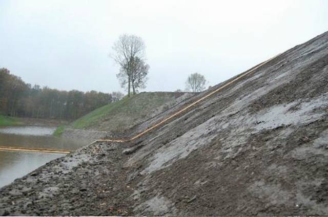
This incredible “sunken” bridge located in the Netherlands. This is world only one bridge, where you can walk between the water.This bridge gives visitors a golden opportunity to walk between water.This bridge is made by a wooden sheet and professional persons. 

Moses Bridge - A Sunken Pedestrian Bridge In Netherlands

Moses Bridge - A Sunken Pedestrian Bridge In Netherlands

Moses Bridge - A Sunken Pedestrian Bridge In Netherlands


Moses Bridge - A Sunken Pedestrian Bridge In Netherlands


Moses Bridge - A Sunken Pedestrian Bridge In Netherlands

Moses Bridge - A Sunken Pedestrian Bridge In Netherlands

Moses Bridge - A Sunken Pedestrian Bridge In Netherlands

Moses Bridge - A Sunken Pedestrian Bridge In Netherlands

Moses Bridge - A Sunken Pedestrian Bridge In Netherlands

Moses Bridge - A Sunken Pedestrian Bridge In Netherlands


source

Netherlands in May - Amazing

Netherlands in May - Amazing 
This place is world most beautiful place in the because its beauty is really pure, you can also see
here most beautiful flowers.
 
Netherlands in May - Amazing
vNetherlands in May - Amazing
Netherlands in May - Amazing